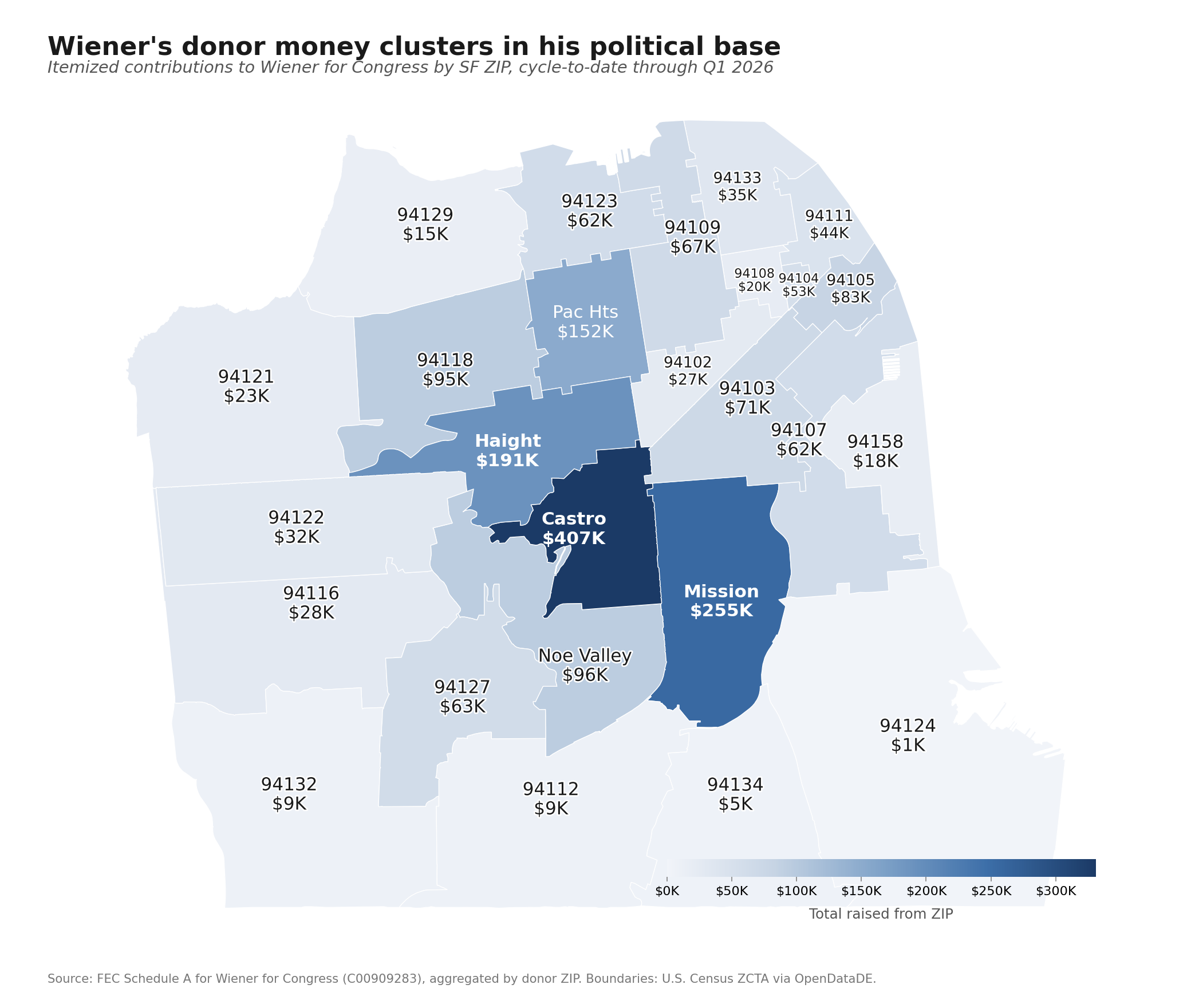
Maps the donor coalitions behind Scott Wiener's CA-11 campaign, including the Abundance backers, AI Safety researchers, his longtime SF professional base, and the tech executives aligned with his anti-wealth-tax position. Built from FEC Schedule A and E filings.
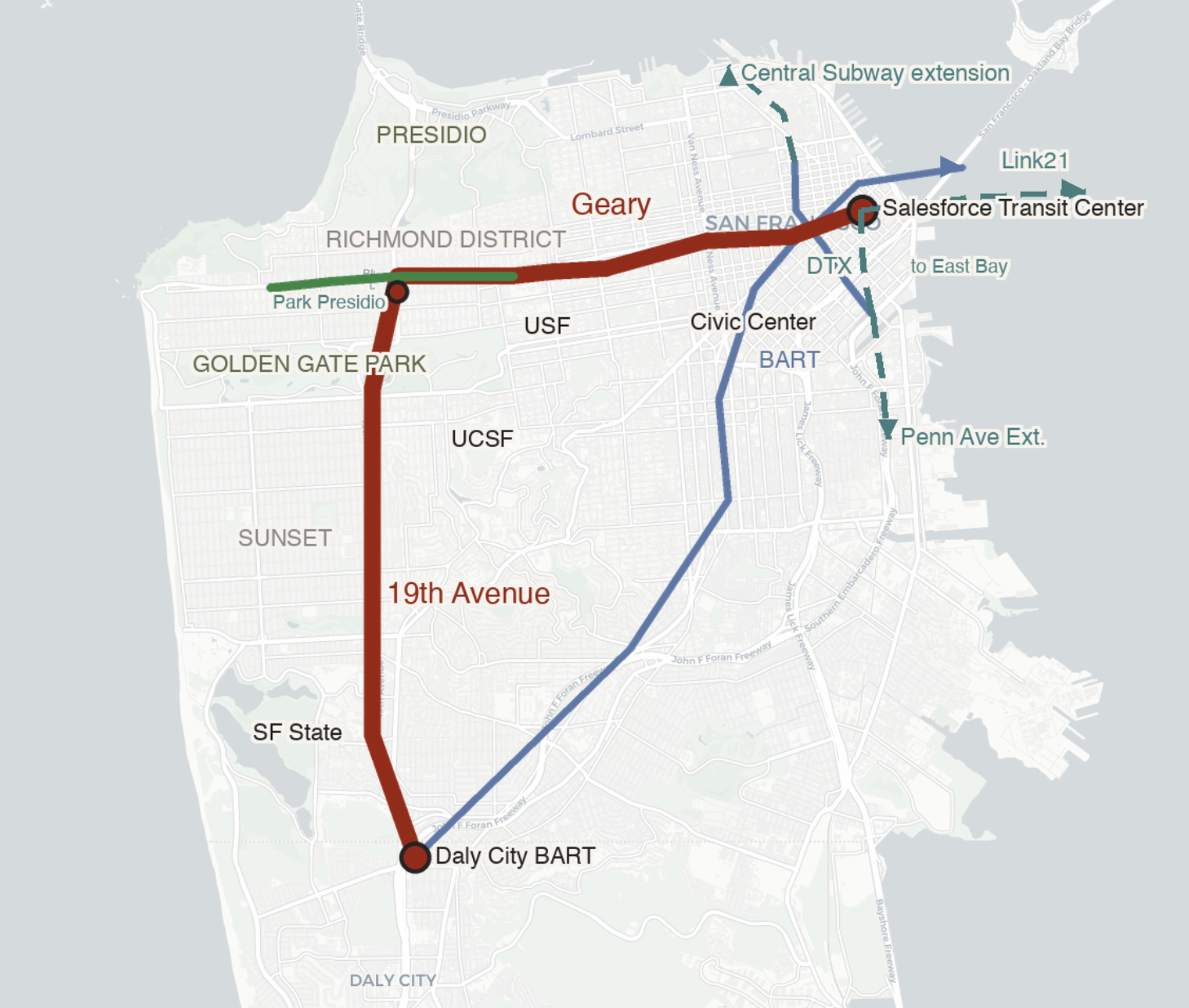
SF's 90-year history of proposing rail on Geary, the current SFCTA subway study, and the conditions the project depends on. Reviews past ballot Propositions to trace what voters approved and what got built.
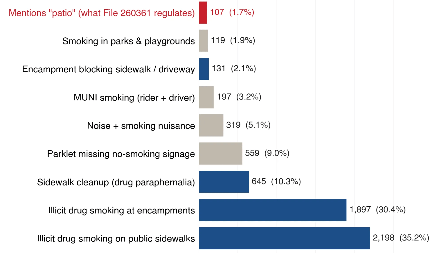
Supervisor Melgar's proposed outdoor smoking ban at roughly 50 SF bars, and why the constituency supporting it is hard to find. Uses 311 complaint records and California Tobacco Prevention contracts to trace where the policy actually came from.
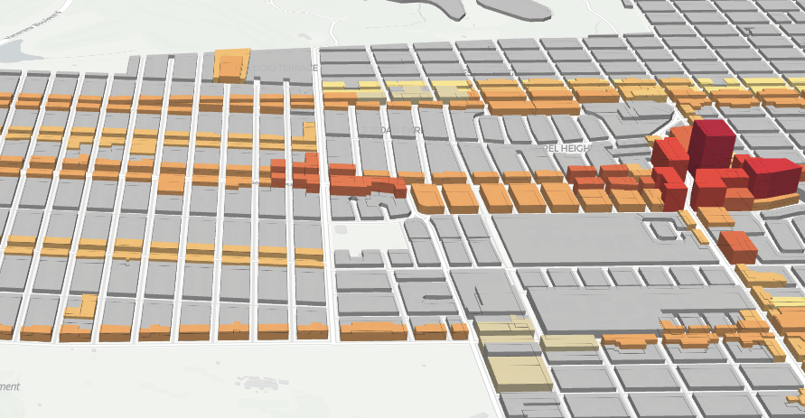
Interactive 3D visualization of proposed building heights under San Francisco's new upzoning plan. Built on the SF Planning Department's public GIS data.
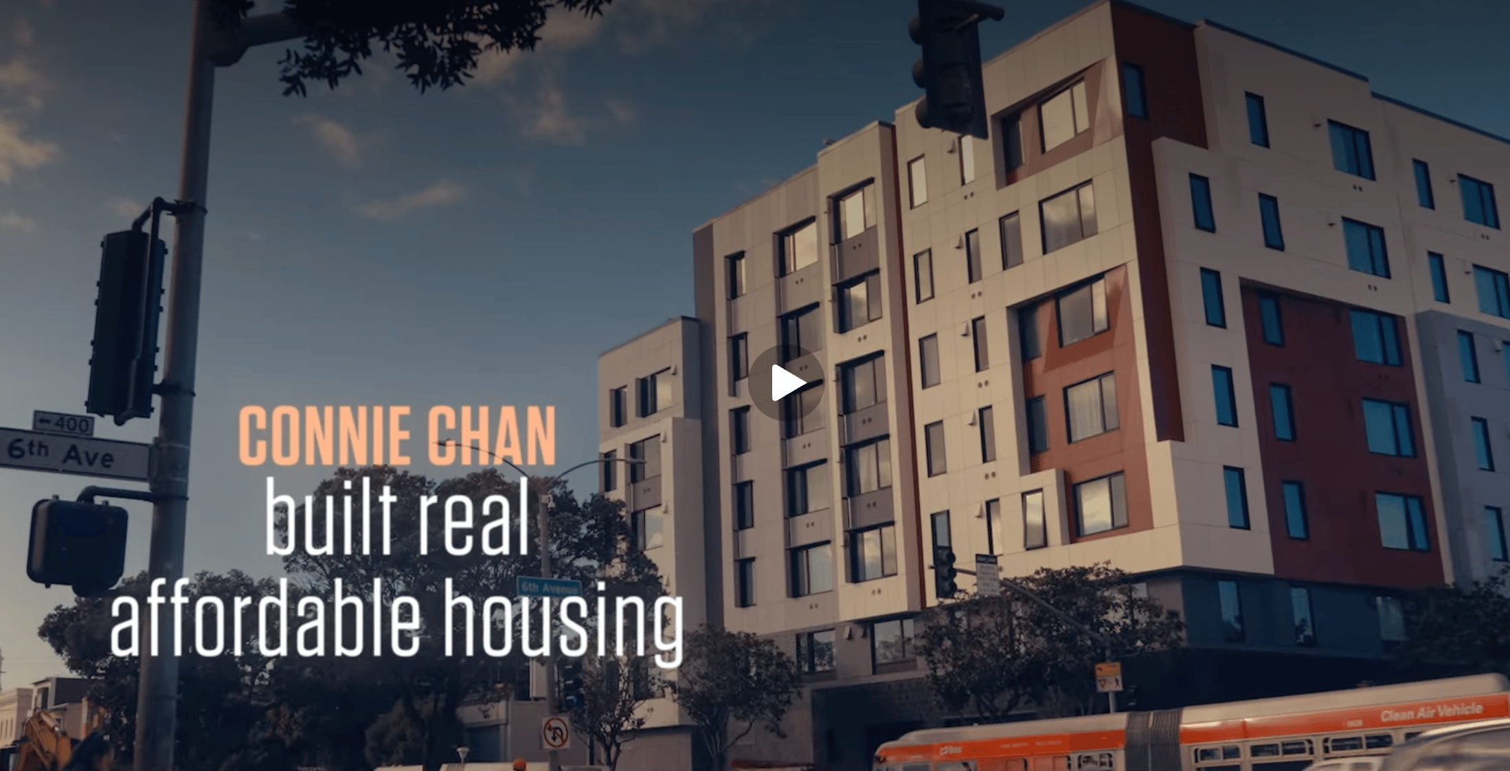
A look at Supervisor Connie Chan's 2020 campaign promises versus her actual legislative record, using the Internet Archive's Wayback Machine to preserve the original commitments.
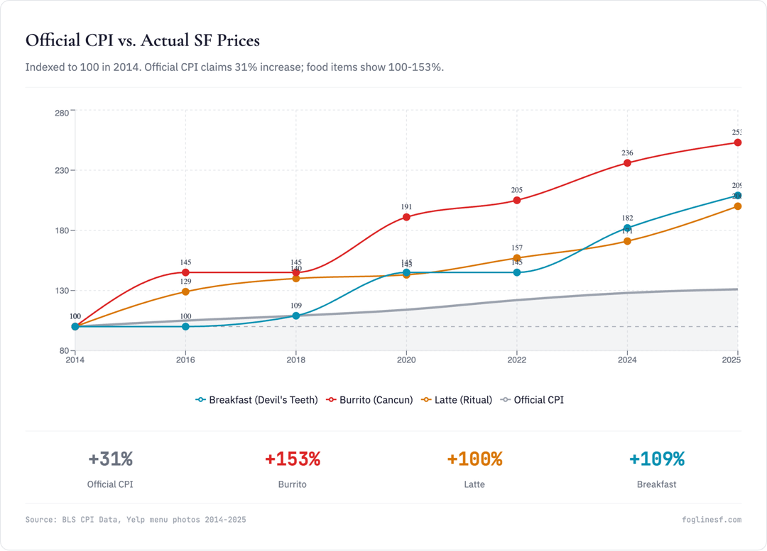
A look at why San Francisco's everyday prices feel like they've risen faster than the official 2.5% inflation figure suggests. Compares historical Yelp menu prices against BLS inflation data.
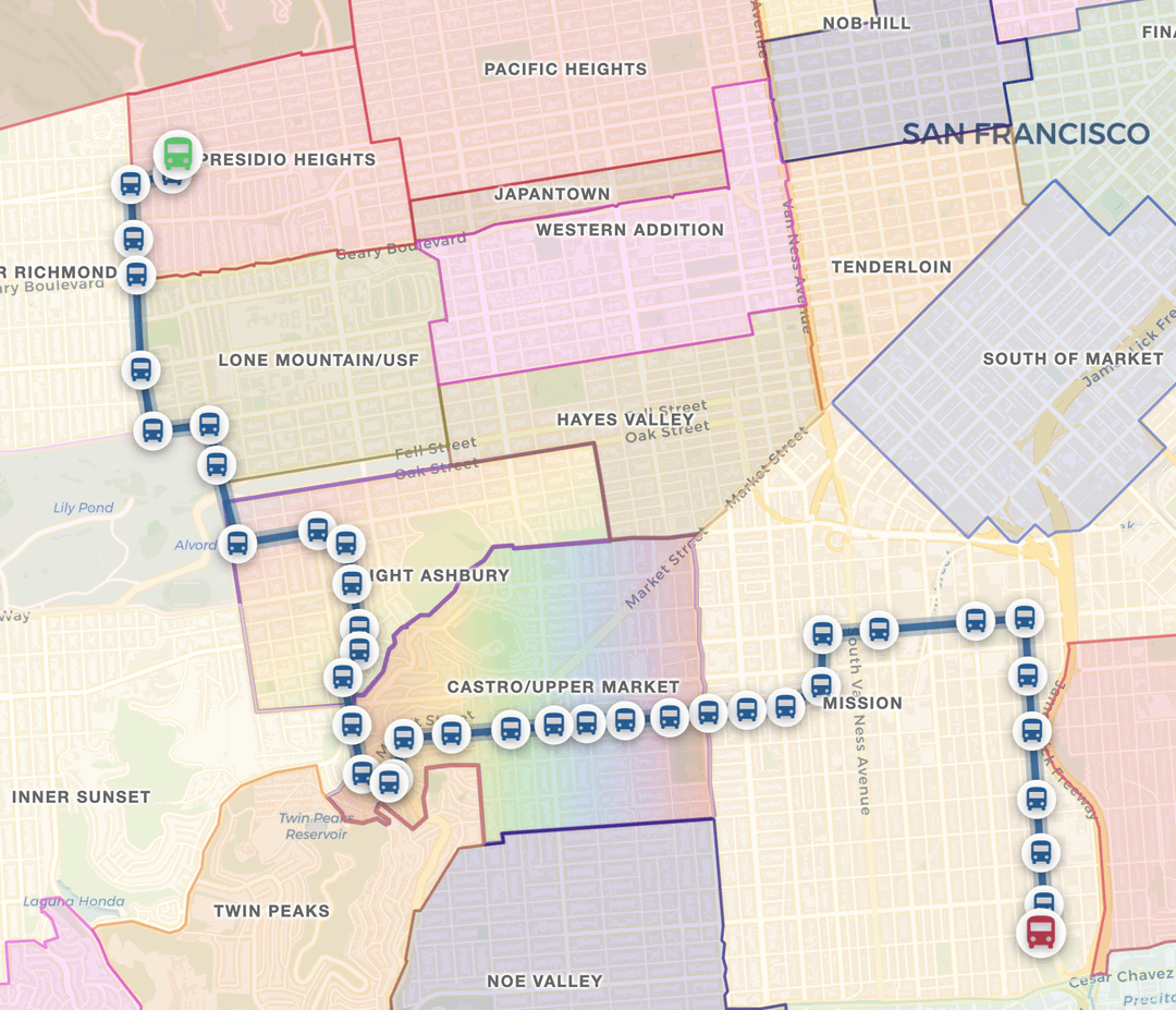
A case for the 33 as Muni's most versatile route, and the neighborhoods it threads together across the city. Maps the route using Muni service data, with photos from favorite stops along the way.